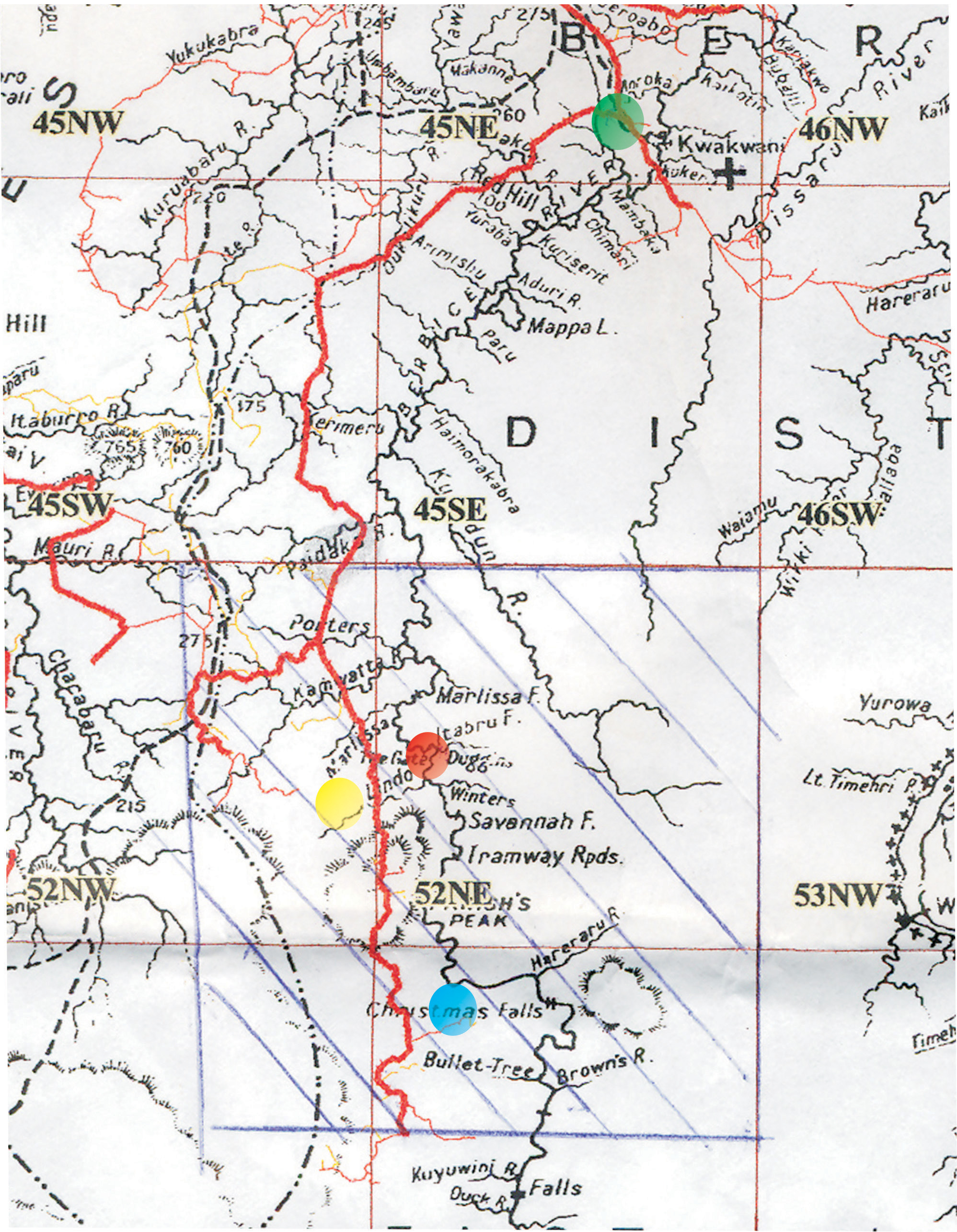
The map at right shows Lindo Creek, where the eight miners were found dead and their bodies burned. It also shows the area’s proximity to the sites referred to in stories on that and other recent incidents involving an armed gang and the Joint Services.The green circle marks the Kwakwani junction, which is approximately a mile and a half from the river crossing and where the UNAMCO road begins. It also represents 0km on the UNAMCO road. Kwakwani is on the right bank of the Berbice River. The red circle marks the UNAMCO checkpoint which is located at Itabru and is approximately 68 km along the UNAMCO road. The Joint Services set up a camp here following the Christmas Falls raid on June 6.The yellow circle marks Lindo Creek, which is somewhere between 72 km and 76 km on the UNAMCO road. Rambo Camp (not shown on the map) is located 72 km along the UNAMCO road. At 76 km on the road there is a turnoff which leads in a south-western direction and approximately one and a half miles of difficult terrain along that turnoff is Leonard Arokium’s camp, where the eight miners were slaughtered.The blue circle marks Christmas Falls, 91 km along the UNAMCO road. In order to get to the falls, one must turn off the UNAMCO road and journey for about four miles. Christmas Falls is at the Berbice River which runs to the right of the UNAMCO road.
Log into your account
Log in for full access to stabroeknews.com. You can also post comments, and manage your email subscription.

Comments