Photos by Sara Bharrat
Flood waters have risen in several villages along the East Coast Demerara (ECD) following heavy showers on Sunday night and early yesterday morning.
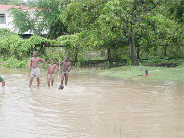
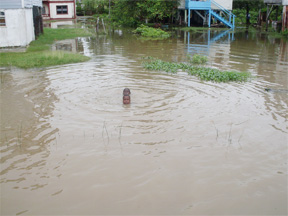
Yesterday a stench emanated from the water and some villagers, who have begun to suffer from skin and respiratory ailments said they were treated. However, this newspaper observed several children playing, swimming or just standing around in the stagnant water, a sign that the health messages have not had the desired impact.
The Hydrometerological Service warned yesterday that rainfall is likely to meet a maximum of 80 millimetres (mm) by Friday.
“Due to heavy rainfall experienced last evening [Sunday] and early this morning [Monday] in Regions Two, Three, Four and Five, the accumulation of water continues in low lying areas of Canal Numbers One and Two Polders, and areas along the East Coast Demerara,” the Ministry of Agriculture said in a press statement yesterday.
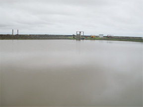
Lionel Wordsworth, Chief Executive Officer of the National Drainage and Irrigation Authority (NDIA), “indicated that pumps and sluices are operable and are being closely monitored.”
However, Wordsworth said that while the water levels along the coast of Regions Three and Four are “receding rapidly” there has been an “incremental increase” in the water level in upper Mahaica and Mahaicony Creeks.
The East Demerara Water Conservancy (EDWC) is being constantly monitored and evaluated, the press release said, to ensure that there is no threat to its structure. EDWC’s embankment crest is 59 GD (Georgetown Datum) and the current water level is 57.45 GD, which according to the ministry, indicates that the conservancy has not reached its full supply.
According to the weather forecast, today and tomorrow will see cloudy conditions with occasional showers over most areas. Between 5 mm and 25 mm of rainfall is expected over Regions Two to Six.
Things will get more intense for these regions and Regions Seven and Ten Thursday through Friday as cloudy overcasts with moderate to heavy showers and thunderstorms are expected.
The Buxton basin
Just behind Buxton Company Road to the left of its drainage station there is a huge basin. The floodwater according to a worker who did not identify himself, is pumped into the basin and then into the Atlantic Ocean.
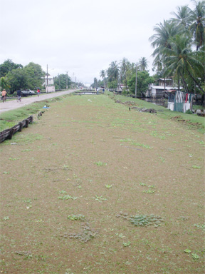
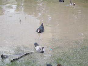
When Stabroek News visited the area shortly before 1 pm yesterday many yards located along Company Road had up to 12 inches of water. A foul odour emanated from the water and livestock, mainly ducks, could be seen paddling about freely.
“We have to let our stock roam freely because we can’t just leave them held up in the water,” Luther Newton, a farmer who resides in the area said.
Newton explained that since the water began rising last Tuesday crops have been washed away and many poultry farmers like him are being forced to market premature stock to avoid suffering further losses.
The Buxton Drainage Station has been pumping water into the basin without a break since last week. However, the water level continues to fluctuate. At present it has risen a few inches.
“Yesterday [Sunday] the water receded approximately 8 inches and I think the water is about 50 inches today,” the pump operator estimated.
He explained that he does not have a gauge to monitor the water level. The wooden gauge which was used by the pump station rotted some eight to ten months ago and has not yet been replaced, the pump operator said.
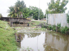
The Side Line Dam trench to the west of Company Road has a koker located at its mouth. However, that koker can not be used because the basin is located directly behind it. The water level in the basin is higher than that of the trench.
Parallel to the trench is the narrow Side Line Dam. If the water in the trench increases by an inch it will be level with the dam. Many residents are fearful of the consequences if the Side Line Dam trench overflows.
Moving in for a closer look at the basin Stabroek News observed that about two feet of mud has been banked up around the basin adding to its capacity.
A foreman who was on site at the time told this newspaper that “the mud banked around the basin is not an indication that the basin is overflowing”.
Dazzell flood woes
“I trust in God…I believe that he won’t let what happened in 2005 repeat itself. I am a woman of faith,” Janet Sweeney said as she bailed water from her Dazzell Housing Scheme, Paradise home yesterday.
Dazzell Housing Scheme is one of the many areas along the ECD which is being affected by the steady showers of rain. Residents, like many others who live along the coast, told this newspaper they live in fear of a flooding worse than 2005.
The entrance of the housing scheme is located on the southern side of the Railway Embankment road. A main road leading into the scheme runs through its 23 streets from north to south.
When Stabroek News visited the area at approximately 1.40 pm there was up to two feet of water on both the east and west sides of First Street. Residents there explained that the water level had risen during the heavy rainfall on Sunday night which continued into the early hours of yesterday morning.
“The water is not being drained off…we are being promised temporary pumps but I think given the situation this area needs permanent pumps,” G. Johnson, a resident of First Street, said.
Moving further into First Street to Sweeney’s home we met the woman bailing water from the front verandah of her one storey house. She told this newspaper that water started to accumulate in the area since last Tuesday.
Another resident, who refused to identify himself, said that the water had receded approximately eight inches on Sunday but the rainfall that night caused the water level to return to where it was in some sections.
Second Street was entirely submerged while the eastern side of Third Street was visible. Stabroek News was able to discern from residents that the western end of the streets, especially from Sixth Street onwards had more water.
As we traveled further into Dazzell along the main road Sixth to Eighth and Tenth to Nineteenth Streets were fully submerged while the water was lower in some part of Ninth Street. However, from Nineteenth Street to Twenty-Third Street the main road was no longer visible.
Fitzroy Johnson of Lot 126 Nineteenth Street said the water was beginning to smell offensive.
“Whenever we got to go out in that water it itching our skin…doesn’t look like it going anywhere anytime soon,” Johnson stated.
Health care
According to Johnson, health workers from the Oxfam organisation were in the area on Sunday. The health workers, he said, examined his children and gave them medicine for their colds and skin rashes.
In an effort to provide further health care for communities affected by the recent heavy rainfall the Ministry of Health announced that all Community Health Centres and Health Posts on the ECD will be opened for extended periods during the rainy season.
A Government Information Agency (GINA) press statement issued yesterday said “the ministry noted that currently mobile health teams are on standby in the event there is need for them to be dispatched”.
Further, the GINA release stated that a team of three medics and support staff has been treating persons at Plantation Hope, ECD. According to Minister with the Ministry of Health, Bheri Ramsarran, adults were treated for Respiratory Tract Infection (RTI).
However, although efforts are being made by the various organisations to provide health care for those affected by floodwaters many villagers still have not had access to a mobile health team or managed to visit a community centre.
Many Buxtonians, villagers from Brushe Dam, Friendship and Dazzell Housing Scheme are still in need of medical attention.


