A recent study conducted in the area which is on the border between Region Seven (Cuyuni-Mazaruni) and Region Eight (Potaro-Siparuni) indicated that there is evidence of the presence gold deposits in the area.
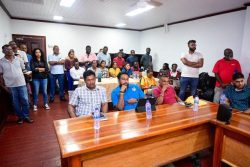
This disclosure was made at a presentation by American Professor Lawrie Minter at the Zoom Inn on Croal Street on Thursday last. Professor Minter, along with a team, started working in the area known as the Roraima Basin ten years ago. The basin encompasses approximately 70,000 square km.
In his presentation entitled ‘Geological Information on Prospective Areas for Auction-Ex-Goldstone Reconnaissance Permission’, Minter said that he and his team worked through tough terrain in the area. He said the team encountered fossil streams, dimensions of which range from 100 to 600 sq km. He said this underground discovery along with other pieces of evidence was a clear indication of gold deposits being present. Using satellite technology, spectrometers, probes among other pieces of equipment, the team drilled and analyzed holes which were made at specific areas. He said this determined the extent and location of the deposits and noted that the alluvial soil beneath the area has been moving in a general south-westerly direction. He said the deposits may have been in the basin for over 2000 years. Minter also noted that the appearance of the soil to the naked eye could give an indication of the presence of gold.
He disclosed that the areas where the prospects of gold being present are at Arawai, Chi-Chi and Kurupung in Region Seven as well as an area known as the ‘Mahaica Locality’, located in the vicinity of Kurupung. In addition, prospects are also possible at Eping and Karanang in Region Eight. He said research conducted at Parish Hill in the Berbice River also gave an indication of the presence of gold.
Kampta Persaud, Manager, Geological Services, GGMC, noted that there are already persons with mining claims working in the area, but the GGMC will hold an auction in the last week of October this year.
Meanwhile, Prime Minister Samuel Hinds, who was present at the forum, in his remarks noted that Prof Minter had approached the government to conduct reconnaissance work in the ‘90s and was given permission based on his knowledge, intelligence and experience in the field of geology. He said he was impressed with the presentation and expressed hope that such presentations can be a frequent occurrence in future. On another note, the Prime Minister said that evidence shows that there are mining operators who attempt to “make peace” with the GGMC officers in the mining districts. However, the prime minister noted that the advent of technology has enabled satellite images of the earth to be easily obtained and images of mining areas can be obtained hence, the authorities can determine whether persons encroach the boundaries of their claims. In addition, he urged mining operators to improve the living conditions of employees so that relatives can occasionally join their fathers and sons, keeping family ties intact.
