-Kwakwani road impassable
By Cathy Richards
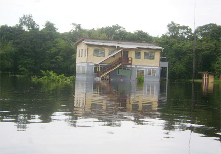
Rising waters continue to cover homes and farms in Region Ten yesterday with a section of the major road linking Ituni to Kwakwani being flooded, stopping traffic between the mining communities.
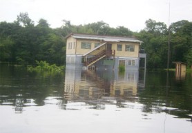
Swollen creeks burst their banks and flooded communities in the Upper Demerara/ Upper Berbice area. Parts of Kwakwani had been under water for several days, said Devon Bremner, the Assistant Regional Executive Officer of Region Ten. He said yesterday residents are praying and hoping that the situation would return to normal within the coming days.
Officials visited flood-affected communities to assess the effects of the flood yesterday but residents have seen little relief. Some food items are expected to reach some communities today. Agriculture Minister, Robert Persaud deployed extension officers to affected areas to assess the situation and provide technical and other support to farmers, the Ministry said in a statement. Persaud also ordered the Guyana Forestry Commission (GFC) and the National Drainage and Irrigation Authority (NDIA) to provide support to the various agencies responding to the affected hinterland and riverain communities.
Heavy rains combined with high tides over the past few days flooded Upper Demerara communities. Flood waters rose to high levels in homes, covered farms and roads, cutting off access to some communities. Bremner told Stabroek News that he visited an area along the Linden/Kwakwani road where two creeks at the bottom of a hill, some five minutes from Ituni, overtopped earlier yesterday, leaving the road inundated and impassable.
He said that motorists opted not to use the road yesterday as the water level in the area rose significantly over-night. Late yesterday afternoon Bremner stated that the water level in the area continued to rise. He also revealed that a culvert along the road collapsed and said machinery provided by the Works Ministry is being mobilised to take into the area. However, some passengers travelling out of Kwakwani got across the flooded section by disembarking at a dry area along the trail and then “walking up a hill” situated above the flooded section of the road. Bremner said buses were waiting on the other side of the affected location to collect passengers.
The entire situation is being assessed for the best possible solution, he said.
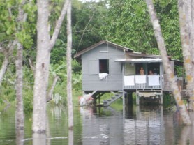
Meantime, in Muritaro, one of the worst affected communities, most persons were forced to leave their homes for higher ground while some chose to stay. Instead of walking on the white sand to get from one place to another, they now use boats, this newspaper observed during a trip to the community yesterday.
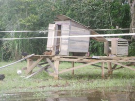
Logging and fishing in the Amerindian community, along the Upper Demerara River has ceased and children are stuck at home, unable to get outside to play. Residents normally use the now heavily contaminated river water for domestic purposes and continue to do so. In addition, hundreds of thousands dollars worth of equipment is under water in the Muritaro bond. The lone telecommunication unit is under water too.
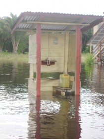
“The situation here is too bad. We need help, medical supplies and we need it now”, pleaded Sylvie Spenser. She said that getting food is the major problem for most families since most are unable to get to Linden because they can’t afford it. “My farm is on the highland so that’s not affected but getting to the farm I have to wade through a really big swamp”, she said. Other residents echoed her cries.
Further down the river, in Speightland, the floodwaters washed out homes and farms. Sunetta Jacobs, a community leader in the area blamed their problems on the area’s poor drainage. She said that despite the excavating of the Kara Kara Creek which run through the community, Speightland continues to suffer from floods.
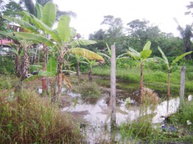
She further explained that because the internal drains have not been cleaned for quite some time, they have been over grown by thick vegetation. Additionally, whenever the tide rises, the water flows over the banks of the Kara Kara creek. In Speightland, several farms are under water and some farmers said their animals are affected. “My brother can attest to this. He was able to put the piglets in elevated dog kennels but the bigger pigs are all left in the sty which is flooded out”, said Jacobs.
Data
Meantime, the Hydrometeorological Service said that data available indicates that over the last 36 hours, inland locations especially along upper Berbice and Demerara areas experienced heavy rain. Rainfall figures range from 75mm to in excess of 100mm in some locations. Mabura, in the mid-Demerara watershed recorded 186.2 mm of rain, while Kwakwani in the Berbice River basin recorded 442 mm so far this month.
Except for a few locations, the Met Office stated that most stations have recorded in excess of 100 mm of rainfall so far this month and these periods of heavy downpours in watersheds which are already saturated have increased the risk of flash flooding in inland and interiors locations.
The Ministry of Agriculture stated that the agency has deployed technical staff and other resources to support other agencies and local government bodies’ national response to communities in the Upper Demerara River whose river banks have been overflowing due to excessive rainfall and the unusual level of the high tide.
The Ministry’s statement said that Persaud has mandated the NDIA to intensify its planned work programme in supporting the Region 10 administration in dealing with areas affected. Two excavators are working at Coomaka Village and a culvert along a main canal will be rehabilitated. Previously, the NDIA had used the excavators to dredge the Kara Kara Creek which works prevented severe effects, the release added.
It also said that NDIA engineers were deployed to the affected areas to undertake further assessments and implement possible interventions, while the Authority’s Community Drainage and Irrigation Project workers assisted in the clearing of drains and waterways. As such, water is receding quickly at low tides and presently, the Authority is considering the installation of self acting doors at main drainage outlets to alleviate the intrusion of river water, the statement said.
Meanwhile, GFC stations and staff are being used to monitor and provide logistical support and special attention is being paid to minimize disruption of forestry activities. In addition, the Ministry’s emergency plan has been activated and its agencies will continue to monitor the situation closely and make necessary interventions especially to ensure that food production is minimally affected.
All regional and local bodies as well as residents in affected and vulnerable low-lying areas are urged to remain alert and to assist in the monitoring of key drainage infrastructure as the country is experiencing the rainy season and periods of heavy downpours are likely to continue during this month, the Ministry said. (Additional reporting by Alva Solomon)

