When construction of the Amaila Falls access road eventually gets underway, special efforts will be made not to negatively impact any Amerindian communities within the area of influence, the recently completed Environmental and Social Management Plan (ESMP) for the project says.
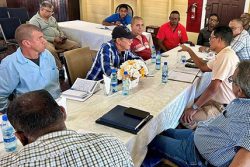
According to the plan, “any work planned within Amerindian lands shall require proper protocols are followed, including review with (and possible approval of) village leadership and Ministry of Amerindian Affairs.” The document said too that “all those working on and visiting the site will respect and preserve the culture, knowledge, and practices of local communities.” A project liaison representative will be appointed by the contractor to meet regularly with Amerindian community representatives and to provide information on the project’s progress and to garner feed back.
The document said too that “the owner (in close coordination with the contractor) will dialogue with the local communities to understand their expectations and create strategies to generate local employment and will consult and engage artisanal miners who use the access road.”
Meanwhile, a “grievance mechanism to receive and facilitate resolution of local concerns and grievances about the environmental and social performance of the project” will be established the report said. According to the document, this process will promptly address all concerns raised by the local community, using “an understandable and transparent process that is culturally appropriate and readily accessible to all segments of the local community”
Further, forest resources cut for the project, which are within the boundary of particular communities, will be made available to these communities, “in so far as that use does not impact the Project operations and approved by the Guyana Forestry Commission (GFC) and MOAA [Ministry of Amerindian Affairs].”
Phase one of the Amaila Falls Hydro Electricity Plant (AFHEP) includes “the upgrading of approximately 85 km of existing roadway, the design and construction of approximately 110 km of virgin roadway, the design and construction of two new pontoon crossings at the Essequibo and Kuribrong rivers.”
The fourth part of the project is for the clearing of a pathway alongside the roadways to allow for the installation of approximately 65 km of transmission lines.
According to the ESMP, “vegetation clearing will be completed for the road corridor and transmission line (t-line) corridor” and “only the final portion of the overall Amaila-Georgetown t-line alignment is to be cleared under this contract, i.e. between the Kuribrong River and the Amaila hydro site.” It said too that “most of that section of the t-line corridor will also contain the access road corridor.” In those areas, the document said, the clearing of the road will be within the t-line corridor.
When phase one begins, the road will start from the Wisroc junction and proceed 26 miles along the Linden/Mabura road before turning off at Butakari in the Essequibo. From there, it will go by the village of Kaburi and will follow the trail up the AFHEP.
The project is expected to commence once the Environmental Construction Permit is given and the international donor agencies indicate their approval of the various environmental assessments conducted.


