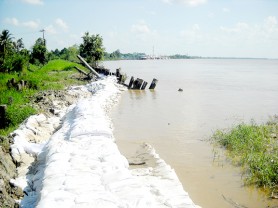
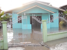
Even as Cabinet has given the green light for $64m in revetment works to be undertaken in the vicinity of the Craig, East Bank Demerea foreshore, experts predict that river flooding there may be far from being solved.
At the same time water from the Upper Demerara watershed, the consequence of heavy, persistent rainfall, which converges in the Demerara River may have dire consequences on the surrounding low coastal areas as flooding in several communities in Region 10 has demonstrated in recent months.
Government engineer Walter Willis told Stabroek News recently that works are currently on-going at the Craig area, close to the bank of the Demerara River. He said that timber revetment is being constructed in the area by M&B Con-struction and the company is presently backfilling the affected area, which is close to 300M in length. He said that clay from another local source is being filled into the area.

Engineer Malcolm Alli had addressed the issue on a number of occasions in the letter columns of this newspaper and he told Stabroek News recently that work on the area has and will cost the authorities huge sums to address. He made reference to a letter he penned which appeared in the columns of this newspaper recently.
In the letter Alli noted that in the 1960s there was some overtopping of the river dam at Craig and at Friendship which the Hydraulics Division monitored but since the Demerara Harbour Bridge was built in 1978 the problem of overtopping has become more acute, causing flooding and hardship to residents along the East Bank from Georgetown up to Friendship and beyond.
The Demerara River during low tide brings down a lot of silt from the upper reaches of the river, Alli noted, and because of the blockage of built-up silt under the supporting pontoons of the bridge, the silt has backed up over a period of 32 years forcing the channel to move further east, causing flooding in Craig and nearby areas. The siltation of the western bank of the river is visible with the naked eye upstream at low tide, he stated.
He said downstream of the bridge has also been affected and the recent high tide was measured at 3.64m, some 1.2m above the tidal amplification for Georgetown, and if correct he said it is indeed a very serious situation.
Calculations should be carried out first to ensure there is a factor of safety in the event of rotational slips in the dam at low tide before works can be undertaken to raise the sea defence in the area.
As a possible solution, he recommended river training works, which can deflect the channel further west but this is expensive and depending on the amount of siltation, may not work.
He also said that digging a drain east of the dam to channel the water at low tide via the sluices may be a solution which is also expensive since people who have encroached on the reserve will have to be removed.
There is a similar situation occurring at the recently constructed Berbice River Bridge causing overtopping on the eastern section of the sea dam and flooding out communities, he stated.

Alli said that bridges such as the Demerara Harbour Bridge are not suited for being positioned near the mouths of rivers, especially when the rivers transport a lot of silt, adding that in a few years time the Berbice River will suffer the same fate as the Demerara River and together with the already ‘dead’ Abary River, the government will have three dead rivers on its hands.
An experienced engineer, who has overseen many aspects of public infrastructure over the years, told Stabroek News recently on the condition of anonymity that the Craig Village area, which has experienced flooding at almost each spring tide in recent times, will remain susceptible to the Demerara River given the geographical layout of the river.
He said that the main problem affecting the river is erosion and he posited too that with the river having several winding turns, it is unclear what could be done at this point by the authorities to adequately address the problem. He noted that in the vicinity of Land of Canaan, and Patentia, villages positioned on the left and right banks of the Demerara River respectively, there is an ‘S’ turn in the river’s layout, a feature which he noted is the main cause of a build up of siltation in the river.
Siltation of the river in question has been an issue which has bothered the authorities over the years as it has proved to be expensive to address; the authorities utilize the motor vessel (dredge), Steve N, to dredge the river bed each year.
But the expert noted that the flow of water down the Demerara River out into the Atlantic has the potential to cause silt to build up at the turns along the river, with the ‘S’ turn being a key factor. He explained that water flows at a constant velocity down the river and as the water approaches features which may cause its speed to slow down, silt is deposited at the points where friction is experienced most. He said that as the water continues on its way after passing the frictional bends, it may carry silt along and as the pattern continues silt will build up along the waterway.
Another engineer, Melvyn Sankies noted that the authorities may have to study the pattern of flooding in the area and develop a plan to address the issue over time.
In 2009, Director of Ports and Harbours within the Maritime Administration Department (MARAD), Taig Kallicharran, while speaking at an engineering conference stated that a major problem within the Georgetown harbour is siltation. He noted that in 1980 the Demerara River harbour was dredged to 6.9m Chart Datum. However, this has not been maintained since only minimal dredging has been carried out over the years.
He explained that after dredging, a river channel requires constant traffic to ensure silt and other particles are kept towards the river banks.
Referring to Port Georgetown, Kallicharran said that the berths within the harbour are sited along the east bank of the Demerara River while no major wharf exists on the west bank since the area is too shallow and a lot of sandbanks are located in its immediate vicinity. The government discontinued use of the Vreed-en-Hoop stelling several years ago.
Kallicharran noted that MARAD has a hydrographic survey unit but the unit does not have a suitable vessel to carry out surveys which is an essential aspect of dredging. He contended at the time that the department was in need of a buoy tender vessel to assist the dredging process as well as other aids to navigation.

He said that a number businesses operating along the ports on the Georgetown side of the river utilized private companies to dredge the areas close to their operations, every three months. He said a study would have been undertaken to ascertain why this was being done since historically dredging occurred every 2 to 3 years.
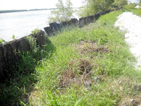
Cabinet recently cleared a $64.8M contract for the construction of greenheart revetment at Craig. When Stabroek News visited the area this week, works were being undertaken by the contractor. It was evident that the revetment works previously carried out had sunk under the river banks and residents noted that while revetment work is a possible solution, a more viable solution should be undertaken in the long run.
Persons there stated that the revetment initially started to rot, and over time with heavy silt building up under the base of previous works, the entire infrastructure began to fold over into the river. Two sections of the revetment appeared to have slipped under the river over the years and the level of the river, one resident noted has risen in recent times.
It was also noted by the experts that most of the main rivers in Guyana run in a north to south direction, with only the Ireng River which lies on the Guyana/Venezuela border running in a southerly direction.
With heavy rainfall in hinterland areas, and global warming taking affect, a large volume of water flows down the tributaries of the Demerara River annually. The resultant effect has proven to be flooding in several areas, such as at Kwakwani and its environs, and as water levels rise worldwide, it was posited that in a few decades persons living on the coast may experience frequent floods.


