By Valrie Grant Managing Director GeoTechVision
Whether you are operating a small business, a large regional enterprise, a government department or a utility company you certainly will need information and in most cases information that has location attributes – that is, ‘where?’ Everything is located some “where” and as such many of the problems we face as a society are geographic problems or have a geographic component.
GIS Explained
GIS is the technology that enables the modelling of real world features and situations in a computing environment in order to map, analyse, and provide intelligence for managing real-world problems. The data used in this geographic analysis is spatial data, which means it is referenced to a location on the earth’s surface. GIS is able to bring together many types of data / information from multiple sources which then allows various types of analysis to be conducted. This is where the real power of GIS lies – combining mathematical models, statistical analysis with geographic references to enable spatial analysis and modelling of real world situations.
Over 70% of all information in circulation possesses a geographic component. To do a simple test, try to think of something in your daily routine that does not have some element of location. What did you come up with? … The answer to that question helps us to appreciate the importance of GIS, as a matter of fact; it is critical to basic everyday decisions and activities. We actually use aspects of GIS daily without even knowing.
Examples of Day-to-day Application

Guyana has a large landmass with tremendous natural resources and a shoreline below sea level which requires protection and monitoring. Guyana is also a rapidly developing country and as such Geospatial Information/Intelligence is one of the most critical elements underpinning decision making in addressing challenges related to Economic Development, Environment and Resource Management, the problem of Climate Change and Disaster Management.
Consider, for example, a system which enables engineers to better monitor and manage critical aspects of sea defence structures. They are able to use GIS to tell when segments of the sea defence structure is in need of maintenance. Of course, the GIS system must be fed with the most current data regarding features or status of anything that impacts the sea defence infrastructure.
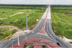
GIS can also help utility companies to manage and coordinate their efforts in a given project area. Take for example the various agencies and utility companies involved in road works. Using GIS- which is fed with data such as the where, the timing, what will be done and by whom- an online pictorial view, accessible from anywhere by the various agencies involved in the road project can be generated. As the GIS system is updated with the progress – all stakeholders can have the same view of what is happening at any given time. This provides better coordination, removes overlapping and prevents reworking thus reducing costs and the attendant wasting of resources. How often have you seen road works done and in a short while, see a utility company digging up the said road surface to do their work? This is often the result of lack of timing and work coordination. A GIS system, accessible to all these entities with the requisite information can help to prevent these kinds of situations.
GIS is also being used to combine and manipulate demographic, lifestyle, and other customer-related data to pinpoint areas of untapped business opportunity. A Retail Store chain may choose the location of a new branch by modelling Shoppers’ behaviour using a GIS. This may be generated using information obtained from the population census and from the store’s experiences in other locations.
GIS techniques may be used to manage the placement of all litter bins within the Georgetown area and analyse if they are properly positioned within an easy walk of major fast food restaurants and other sites where people traverse. This helps in managing waste disposal and the protection of the environment.
Moving Forward
We live in a rapidly changing world and our future is contingent on our actions and intervention today. As we shape and define the future, it’s important that comprehensive planning takes into account all key aspects that impact our existence. GIS helps us to integrate data from disparate sources to better understand our world so we can meet development challenges. By applying what we know of science and GIS to what we do not know, we can get to what we really need to know. The aim is to enhance the quality of life and manage the environment to ensure a better future.
Everything you have read in this article so far has a location component and therefore spatial in nature, so we have to apply spatial tools and spatial thinking. Creating and applying GIS tools and knowledge allows us to integrate geographic intelligence into how we think and behave. GIS helps us perceive intricate environmental relationships that otherwise we would never be able to see or understand. The result – better planning, sustainable environmental and economic decisions and ultimately the preservation of life.


