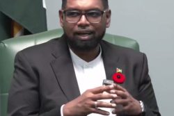
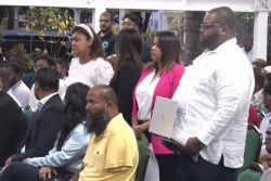
A Neighbourhood Democratic Council member believes that there are discrepancies between the Guyana Lands and Surveys Commission’s records and the actual ground measurements at the East Bank Essequibo village of Farm, which has led to the unfair allocation of lots.
Councillor Richard Waddell made the assertion in testimony before the Commission of Inquiry into African Ancestral lands and other land matters yesterday, when he told the tribunal that he believed that a plan made out in 1888, following a survey the year before, is the cause for the inaccuracies.
Waddell, who said he has been a councillor for 43 years, noted that the inaccuracies have caused residents to be robbed of portions of their land during development and, as in his case, some gaining additional land.
Waddell said that he had been in possession of an older plan, but noted that it has been misplaced.
The witness gave the commission several examples to support his claims, including the fact that he believes that about 18 to 24 feet of the land he is currently in possession of is not his.
“I am positive that I’m having about 18 to 24 feet of land which is not mine. Somebody gonna pay the penalty. And I want to know if it’s the measurement because there was once a surveyor who took away all of my land except three rods and that has caused me not to use my land for more than 12 years,” Waddell related.
He said that as a result of the blunder, his ¾ lot is bigger than a typical lot size.
In addition to this, Waddell noted that because a koker appears to have been omitted from the plan, the lots at Section 1 Farm have all been shifted eastwards. “Section 1 is the most northern side of Farm and it is divided into 26 lots. So each shareholder had a lot there. There is an old koker dam which is about 60-ft wide. There is plan now showing that that 60-ft width of land happens to be 2 house lots and it’s showing lot 1 and 2. This means that every other lot had gone eastward,” he said.
In Section 2, he added, there is a “missing” quarter lot that was being claimed but could not be located by the surveyor.
Waddell related that while villagers know the dam between sections 2 and 3 to measure about 24 feet, the plan reflects it as being as much as 48 to 54 feet, which caused problems when the council, back in 1976, decided to construct an 18-ft drain without first notifying neighbours.
He related that after villager Joyce Cameron sent a letter to the council, they were forced to stop.
Another issue he raised is the inaccessibility of the backlands for cultivation, as the parcels are split.
The other matter Waddell raised is one concerning the rights to land occupied by a relative for decades at Ruby—also on the EBE—which was awarded to another, who claimed it through prescriptive rights.
Waddell told the commission the story of how his aunt-in-law, Anita Rodney, who lived at a property in Ruby for 90 years, was challenged by a Nazir Mohammed, who claimed prescriptive rights over the land.
He stated that the land, a double lot, had been passed down to her by her
grandmother. This newspaper understands that a transport was only held for one portion of the lot.
The witness said that 2 years ago, after Rodney would have passed away, they learnt that the land was awarded to Mohammed.
“Honourable member, I see this as some sort of injustice. Because after living on that land for at least 90 years, it was something handed down from the fore parents, there is a house on that land that was built between 45 [and] 50 years, which is still standing. And to give someone title over something that they have not lived or paid rent is an injustice,” Waddell stated, while noting that such a claim calls for a person to be in occupation of the portion of land for 12 years, which was not the case.
He further stated that the man had been going out seeking land that was not registered, and now has prescriptive rights for the entire Naamryck Front on the Essequibo Coast.
While he acknowledged that it is difficult to have a court matter overturned, Waddell enquired from the commission what course of action could be taken to have the land held within the family.
After yesterday’s hearing, the inquiry will be on break until October.
The CoI’s mandate is to examine and make recommendations to resolve all the issues and uncertainties surrounding the individual joint or communal ownership of land acquired by freed African; claims of Amerindian land titling and other matters relative to land titling.
It is being chaired by Reverend George Chuck-a-Sang, with Khan-James, David James, Professor Rudolph James, Lennox Caleb, Berlinda Persaud, and Paulette Henry serving as commissioners.


