Key swathes of mangroves are under threat from a natural erosion cycle, according to NAREI, which recently held a discussion with West Demerara residents to highlight the problem and explain what is being done to strengthen sea defences.
Mangroves provide natural protection from the sea and many parts of Guyana’s coastline are protected by them.
In a press release on Tuesday, the National Agricultural Research & Extension Institute’s (NAREI), Mangrove Department said that mangroves across the coastline of Guyana are currently being threatened by cyclic erosion/accretion.
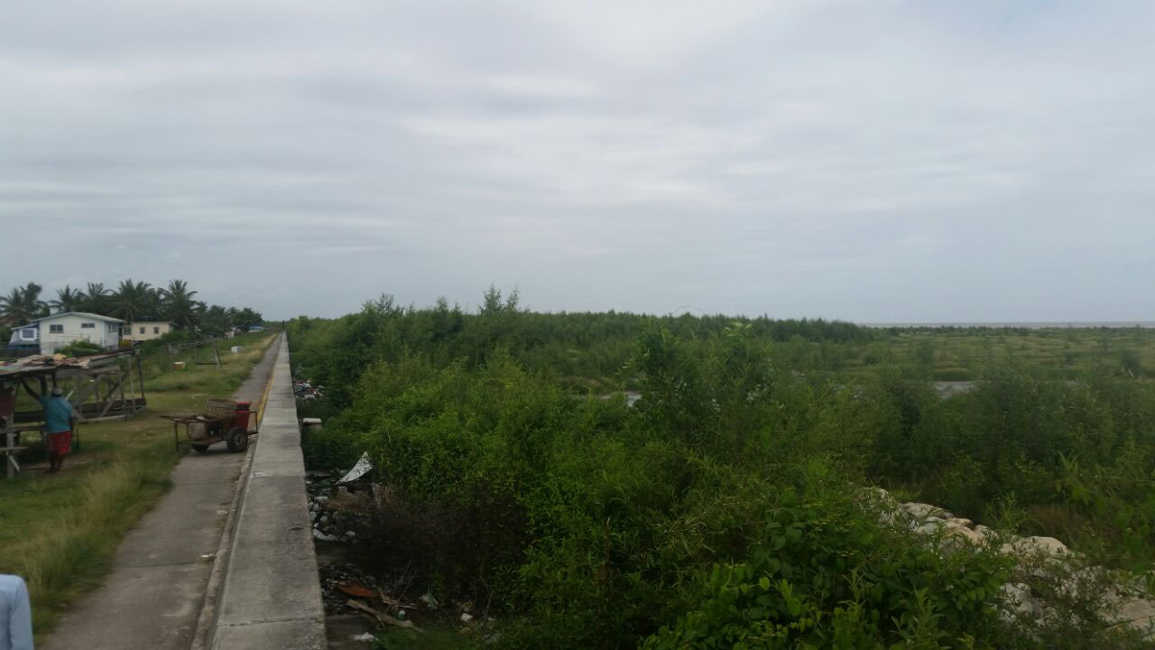
The matter came recently to public attention after concerns were raised by residents of Rumzight on the West Coast of Demerara that mangroves had been removed by the Ministry of Public Infrastructure (MPI) for sea defence work. It is illegal to remove mangroves.
After a news item appeared in Stabroek News on the matter, the ministry stated that mangroves at Ruimzigt had been dying and their removal was to facilitate rip-rap sea defence work. It appeared that the residents had not been consulted on the removal of the mangroves and the pending rip-rap works and in its release on Tuesday, NAREI referred to a consultation that was held with residents last week Thursday.
According to the release, NAREI met with the La Jalousie/Nouvelle Flanders Neighbourhood Democratic Council (NDC) and the discussion centred on the loss of mangroves within the borders of the NDC, along with the current ongoing sea defence project that is being carried out by the MPI.
At the meeting, Kene Moseley, head of the Mangrove Department presented an overview of the monitoring that was conducted by the Institution since 2014, which showed the extent of the erosion and its impact on the mangroves along the shore. Moseley also explained that the situation was being made worse by the excessive dumping of garbage along the shore and the harvesting of mangroves by fishermen for fishing poles.
The ministry’s Sea and River Defence Division (SRDD) District Engineer, Dennis Ramsingh, briefed NDC Councillors on the status of the rip-rap project on the West Demerara and reassured that the works were being done to reinforce the sea defence due to the loss of the mangroves. Due to the nature of the works, he said that the remaining mangroves were cleared to facilitate placement of the boulders. NAREI will continue to work with SRDD to monitor changes in the cycle and elevation along this stretch of coastline, the release said.
The release explained that the Mangrove Department of the Institute is currently monitoring the effects of erosion on coastal mangroves in Region 3, 4 and 6. It further noted that the erosion is a natural process that occurs in 20-30 year cycles and is currently impacting naturally regenerated and planted restoration sites at Hope Beach, Wellington Park, Greenfield and other villages along the West Coast of Demerara.
“The coast of Guyana is part of a 1600 km-long muddy coastal system dominated by massive mud banks that migrate from the mouth of the Amazon River to that of the Orinoco in Venezuela. According to a study completed by Professors Antony and Gardel in 2013, the dynamics of the Guyana coastline are strongly hinged on pulses of mud abundance or scarcity embedded in multi-year cycles of mud-bank activity and inter-bank phases. The cyclic mud-bank phases regulate mangrove regeneration by providing a substrate for extremely rapid and large-scale colonization from older mangrove colonies and vigorous tree growth,” the statement said.
It further noted that Coastal Engineer at the University of Guyana, Ranata Robertson pointed out that the erosion can be either caused by nature or by man-made interventions such as structures being built beyond the seawall or within the sea defence area, which disrupts the natural movement of sediments and results in erosion.
She also explained that it is paramount for Guyana to continue conducting research to determine the movement of the mud banks and the associated erosion cycle. Studies to map and model coastline retreat and advance are also critical areas of research that need to be integrated into a long term coastal zone management programme.
Currently, there are collaborative studies between UG’s Civil Engineering Department and NAREI’s Mangrove Restoration Programme along with its Sea and River Defence Division to better understand and model the cyclic process.
“While mangroves are subjected to cyclic erosion, studies conducted on Guyana’s coastal mangroves have proven that a mangrove bandwidth of 50m-80m is required to reduce a 3m high wave to approximately 0.01meters. In the areas where mangroves are not present, severe over-topping occurs (along Kingston and Sheriff Street) which results in increased cost for maintenance works over a period of time,” Robertson added.
Moseley said that once the mangrove forest has enough width, it is possible for it to naturally restore itself when the cycle changes and there is accretion and deposition of sediments. However, the natural regeneration is only possible when there is no stress on the system.
The most recent occurrence of the phenomena can be seen along the West Coast of Demearara. The statement said that the Institute has been monitoring the erosion along the area since 2014 in order to assess the changing conditions and the impact on the status of the mangrove forest.
Moseley noted that during the period, the monitoring team observed and documented extensive, rapid erosion along the shoreline. The Windsor Forest, Ruimzigt, Rotterdam and Crane areas were labeled as critical areas and the erosion had “totally cleared” mangroves from sections of Windsor Forest, while the other sections “continued to thin as trees were uprooted.”
In relation to the other sites, Moseley also noted that it was the first time that Hope Beach is experiencing erosion since the mangroves were restored there in 2010, while at Greenfield the erosion is being monitored and research is being conducted on the implementation of engineering projects that may reduce the impact of the erosion and save the remaining mangrove forests.


