Sally Bunning, the leader of a team from the Food and Agriculture Organization of the United Nations (FAO), on a recent visit to Guyana has expressed amazement at the extent of land degradation especially in Region Ten, due to sand mining and the loss of agricultural land to housing and business development in coastal areas.
The FAO team was in Guyana for a week of consultations and meetings with the Guyana Lands and Surveys Commission (GLSC) to initiate the US$14.8 million Mainstreaming Sustainable Land Development and Management (SLDM) project in Guyana, according to a press release from the FAO. The project will incrementally improve land administration, policy and planning as a basis for promoting sustainable land use and the reclamation of degraded lands – steps that are essential to Guyana’s Green State Development Strategy.
According to the FAO statement, Bunning, however, expressed optimism that GLSC has the strategic vision to lead an effective, multi-sector and multi-stakeholder consultative, regulatory, planning and decision-making process on land use and governance to support sustainable land use and management practices by the range of land users. The team leader also noted that the GLSC currently commands impressive technical expertise and managers in the field of geomatics, land administration and management, which is a guarantee for successful project outcomes.
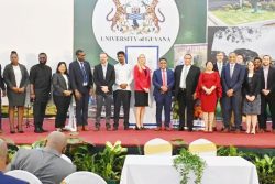
Over the week, a team comprising GLSC staff, the visiting experts from FAO’s HQs and Regional Offices and GLSC’s sister agencies, engaged in joint work and concluded successfully with a prioritized action plan for the implementation of the project activities.
The FAO team shared with GLSC the international framework of reference in matters of good practices of tenure and offered examples of tools and land policy formulation processes, the FAO release said. The joint team also made exploratory visits to areas in Regions Three and Ten to have a first-hand look at land degradation.
The SLDM project will strengthen the capacity of all GLSC’s divisions, improving efficiency and effectiveness of its operations and fulfilling its mandate as the national mapping agency and guardian over all public lands, rivers and creeks in Guyana.


