Most of the great cities in the world were not planned. They had their beginnings in small or modest settlements which owing to their advantageous locations for the purposes of trade, then gradually expanded. They grew organically and usually haphazardly, absorbing neighbouring communities until they reached the magnitude of the metropolises we know today.
Our own Georgetown was both a planned city and grew haphazardly. It was planned in the sense that in 1781 the British selected the site for a town, building a fort somewhere near the museum – although no one is sure exactly where it was − and deciding that the seat of government would be on the strip of land which ran south from the Brandwagt or Dutch signal station, around where Stabroek Market now stands. They had not proceeded very far with this project − they had one office, it has been suggested − when they were dislodged by the French the following year, who immediately saw the advantage of the British plans and decided to proceed with establishing a capital on Brandwagt land just as their predecessors had envisaged. This strip was to accommodate commercial activity and domestic settlement as well as government offices.
If this was the planned bit, the haphazard development began soon after, with various settlements springing up in the neighbourhood, including areas such as Cummingsburg, a kind of middle-class enclave, one might say, and after 1796 when the British returned, Kingston, where they had their camp. (This is reflected in the nomenclature of the ward’s streets, such as Camp Street/Road, and Barrack, Fort and Parade Streets.) In 1812 it was finally decided to amalgamate all these bits and pieces into one city, and Georgetown was born.
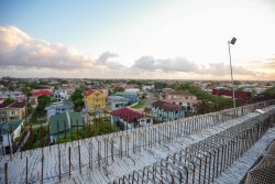
If this gives the impression that our capital was an unorganised urban centre like so many other cities in the world, it would be incorrect. It is, in fact, extraordinarily well laid out. Prior to the advent of the unsightly Marriott Hotel which partly obscures the view, anyone could have climbed the stairs to the top of the lighthouse, and casting their eye around the landscape would have seen the history of Georgetown written on its face. In other words it is a plantation city, the only one of its kind in the world, largely because the various planters who converted their estate front lands to building projects were constrained in their ambitions by the exigencies of the plantation drainage system. As a consequence, our capital boasts an exemplary grid-like structure which would do credit to the most meticulous town planner.
And it seems we now have a town planner as our head of state, who has ambitions of his own to create a new city. He has been talking of this since he was Minister of Housing in a previous administration, but no one paid him much attention then because he was not in any position to implement his ideas. However, now he is forging ahead while providing little information for any of the people affected, or indeed the public at large. We know where the new city is located and a map has been made available showing its boundaries, but exactly what will go where within those perimeters remains a mystery, except perhaps, to the progenitor of these proposals.
President Irfaan Ali is calling his proposed town a city, suggesting perhaps that the intention will be to make it the new capital. His reasoning apparently, is that because of climate change and the fact that there is no more room for Georgetown’s expansion along the East Bank, a new city is required on the higher ground of the Highway. All those who drive up the East Bank to the airport might dispute the fact that there is no more room for urban expansion along that route, although in and of itself that would not be a reason for not embarking on an urban project further inland.
Leaving aside the question of climate change for the moment, there are problems related to the creation of the new city which the President has not yet seen fit to address. The first of these is what actually it will look like. As has been said before in these columns other countries which have shifted their capitals have employed leading architects to ensure that what is created both impresses and is aesthetic. Brazil, for example, employed a group of world-famous architects including Oscar Niemeyer when designing Brasilia, and in 1987 Unesco designated it a World Heritage Site on the grounds of its modernist architecture and artistic urban planning. There is also the case of Islamabad, designed by Greek architects, and Abuja in Nigeria, for which there was a competitive international bidding process won by a consortium of three American architectural companies.
Who is designing President Ali’s urban creation, which goes by the uninspiring name of Silica City? No one knows, although certainly not anyone of Oscar Niemeyer’s stature, if any architect at all. In the case of new cities elsewhere, what is built first are all the public edifices while domestic residences follow after, but in a characteristic display of utter small-mindedness the head of state has stood common planning sense on its head and decided to proceed with the issuing of 100 house lots by the end of the year. It is surely to start the project at the wrong end. He seems to have forgotten that this has been touted as the Caribbean’s first smart and innovative city and is estimated to cost $81.7 billion inclusive of consultancy services, identification, feasibility studies and the execution of the project. Almost half that sum, it has been announced, will be accounted for by infrastructure such as lighting, road development, drainage and culverts, sidewalks, water supply, electricity and land preparation. No mention here of elegant official buildings.
So will these 100 house lots have access to water, etc, even although the larger infrastructural plans are not seemingly yet ready for implementation? And what will the inhabitants of these new houses sitting between Yarrowkabra and Kuru Kuru do for a living? Will they be farming like those they have displaced, never mind that this is supposed to be a new digital centre for the nation? All this sounds like a formula for muddle, even if it is not an outright failure in the normal sense of that term.
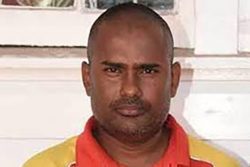
But the worst of this story is that clearing the land for these house lots has already begun, and yet the farmers who make their living there were never consulted. One of them, Mr Sheldon Seabra, said that all they knew about the project had come from social media, and the first official communication from the government had come from Guyana Lands and Surveys ordering them to stop work and relocate. The excavator clearing the area for the project, he said, was just 1000 feet from his farm and they would soon be clearing his crops and destroying his pens. There are about twenty farmers in the area where Mr Seabra lives, and many of them had land leases. In his own case, his had only just come into effect, and now a few days later it was being revoked.
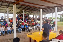
This is disgraceful. How can any government which promotes itself as operating in the interest of the ordinary man and woman treat a group of farmers with such contempt? Of course, the President descended on the area the week before last and listened to the residents’ complaints, telling them breezily that a technical team would be sent into the area to speak with those affected. He said they would have to relocate but would receive assistance from the government to acquire lands where they could continue farming. It remains to be seen whether those who are being displaced in order to accommodate what to all appearances is the President’s still inchoate dream will be mollified.
When President Ali came to office he promised communication with the populace. After two-and-a-half years there is little sign of that. Aside from the farmers in the area, the general public also needs to know about this massive city project, and should be given the opportunity to comment. Why is it that the most being provided at a visual level is just the outer perimeters and the location? Certainly Minister within the Ministry of Housing and Water Susan Rodrigues has held forth verbally on what this digital city is intended to be, but that has little meaning if we do not see maps and plans, even if not designs for the major buildings involved. Is it a case that this is a secret, or is it that the details have not been worked out yet, which is why the government is proceeding in such a ‘cas-cas’ way with house lots?
So the farmers should have been consulted about what is going on and the public at large needs to know in a meaningful sense about what is going on, but there is another group which has further questions. That group consists of the residents of the world’s only plantation city. President Ali has talked vaguely about climate change which is why Silica City is needed, and it is true many concerns have been expressed about the situation of Georgetown which is below high tide level. But we need specifics. To the best of anyone’s knowledge the government has not commissioned a study on the future of the capital given rising sea levels, and whether it can be saved, and if so, what measures are necessary. If the estimation of experts is that in the longer term it cannot be saved, then how long does it have?
The answers to those questions will determine what kind of city the new urban establishment might be, and how big it would have to be. If Georgetown is to be abandoned eventually, for example, what plans would be in place to save its historic buildings, to cite one example? Where would the government buildings be accommodated in Silica City? If it is not necessary in the shorter term, what plans would President Ali have for the further development of the new city should a climate crisis come in the future? Georgetown turned out to be a remarkably well-planned capital; unfortunately Silica City has nothing to recommend it in that department. Instead of dreams we need some serious professional work, starting with the future of Georgetown, and only then moving on to what might be needed in terms of an urban development on the highway. Until that is done, the President should stop the excavator work and leave the farmers for the time being as they are.
Lastly, there is the matter of the name ‘Silica City’ which one supposes President Ali chose because it will be sited on the sand belt. Again, he has held no consultations about it and probably intends to hold none. One might have thought that since it is in an Arawak area an Indigenous name might not come amiss. Even if he refuses to give way he should be aware that posterity has a way of amending even the best laid plans.


